Overview
Since I started mountain biking I have found the trail ranking system to be entertaining. In one bike park I will go down a trail ranked "green" and it will be too easy. Then I go to another bike park and much to my dismay I find that green trails are significantly more difficult. There is no objective measurement of the difficulty of a mountain biking trail. The goal of the additional data logger was to create a system that could measure how difficult a trail is using objective data.
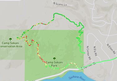
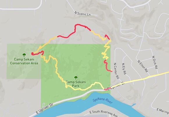
To the left is a map of the vertical acceleration measured by ADL as I rode down the trail. This measurement translates to how rough the trail is. As you can see; the downhill section has quite a few rough spots.
To the left is a map of the vertical acceleration measured by ADL as I rode down the trail. This measurement translates to how rough the trail is. As you can see; the downhill section has quite a few rough spots.
Conception and design
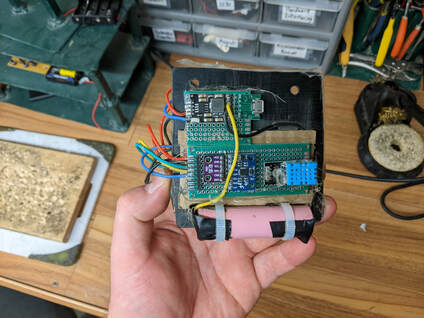
The design of ADL consists of an RP2040 (Raspberry PI Pico) connected to a number of sensors. ADL uses a GPS unit to provide coordinates for each data point collected. It collects acceleration in 3 directions from an IMU, temperature data, air pressure and humidity.
All the data is stored on a micro SD card, which surprisingly; is able to handle all the punishment a mountain bike ride has in store for it.
A rechargeable 3.7v lithium cell provides power for ADL and can provide 4-5 hours of data before it needs to be recharged.
All the data is stored on a micro SD card, which surprisingly; is able to handle all the punishment a mountain bike ride has in store for it.
A rechargeable 3.7v lithium cell provides power for ADL and can provide 4-5 hours of data before it needs to be recharged.
Why Not just use a phone?
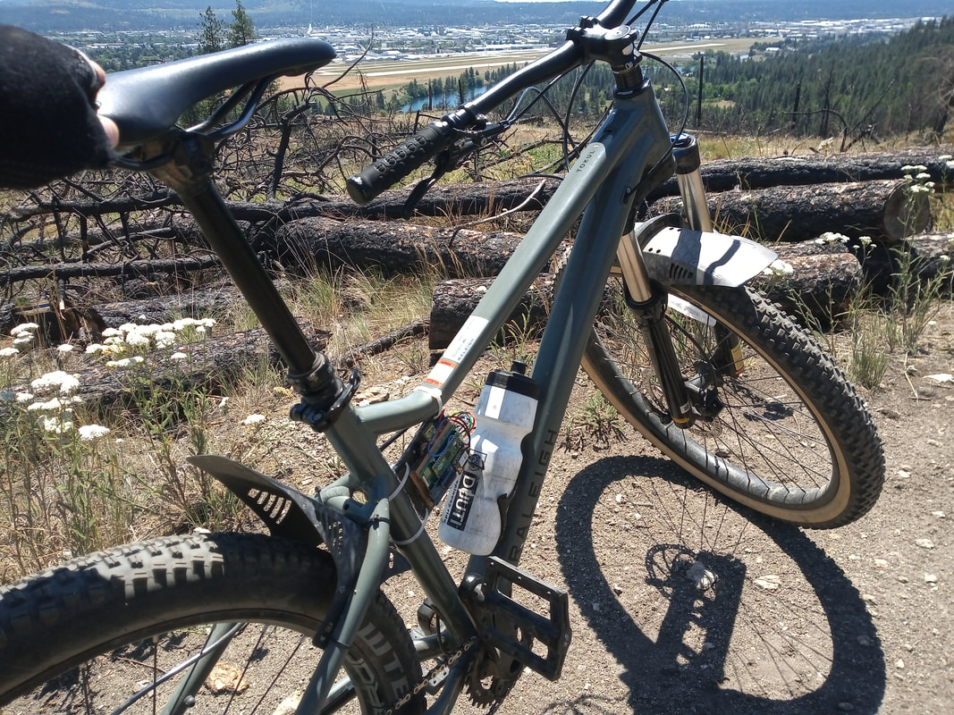
This is the question isn't it? There are a few reasons why a phone doesn't work well in this role. For starters the GPS on a smart phone is often inaccurate. ADL's GPS connects to an external antenna that hangs from the bike frame; providing a significantly better signal when riding in areas with lots of rocks and trees.
Another issue is that not all phones have IMUs. Even the phones that do have an IMU would require the data be calibrated to the phone's orientation. ADL sits vertically on the bicycle so we can always guarantee it will be in the correct orientation.
ADL also contains, a temperature sensor, air pressure sensor and humidity sensor which NO phone is equipped with. Some of the temperature data can be quite interesting as different areas of a trail will be warmer or cooler depending on the ground and tree canopy or lack there of.
Finally, its fun; I really enjoy making firmware projects and this one was a lot more fun then trying to interact with Android Studio.
Temperature Data
As stated previously; the temperature data on a bike ride is extremely interesting. Of course riding when it is hot tends to be more draining, so knowing which trails have the highest radiated temperature can be a useful piece of information when planning a ride.
Data Analysis
|
The data from ADL is processed by an application I developed using the Unity game engine. That application normalizes the data and finds where values are higher or lower than that normal. It's still a work in progress. The application uses MapBox to display the data
|
Status
As of today 11/1/2022 ADL has been on the shelf. This winter however I want to take ADL out on a snow ride to see how the data compares to summer riding. This is a little more dangerous because crashes are far more likely in snow riding and snow would not have a great effect on ADL. That being said, it wouldn't take too much to cover ADL with a simple plastic covering.
